Samwel Cave Nature Trail
The Trail is 1 mile
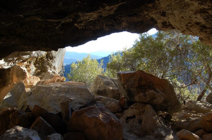
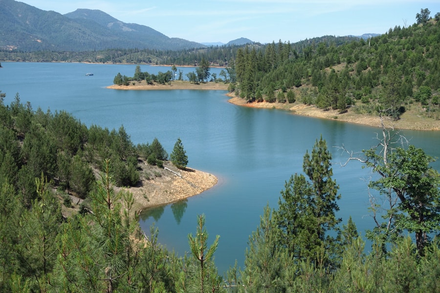
Samwel Cave is noted for its use among the Wintu Indians. Samwel is a Wintu word meaning holy place. Also known as the Cave of the Lost Maiden & Cave of Magic Pools. In the closed portion of the cave, scientists have discovered Cultural Artifacts and Ice Age Fossils. Legends tell of pools of magic powers and Ritual Ceremonies.
Samwel Cave is located at the eastern slope of Bollibokka Mountain with its portal opening southwards to the the upper McCloud Arm of Shasta Lake. The trail, the Entrance Portal with the view and the first Chamber are freely accessible. The rest of the Cave is closed with a gate, for the protection of the Cave and the protection of the Visitors. The Permit and the Key is available from the Shasta Lake Visitor Information Center in Mountain Gate. While there are two fairly horizontal levels, which can be visited without difficulties, there is a deep drop to the lower level which requires Climbing Gear.
BY BOAT: Go to Point McCloud (on the McCloud Arm) across from Ellery Creek Campground and follow the Nature Trail one mile up to the Cave entrance.
Packers Bay Trail System
A scenic, 4-Trail Loop System
There are four Trails in this System:
Waters Gulch Trail -2.8 miles
Overlook Trail – 0.4 miles
Fish Loop Trail – 0.7 miles
Eastside Trail 0.4 miles.
These are open all year, but it is best to hike them in the Spring and Fall. Fish Loop begins at Packers Bay Parking Lot, Eastside begins at Shasta Marina’s Boat Ramp, Overlook and Waters Gulch begin 1/2 mile before Packers Bay Parking Lot (Trailheads and Gravel Parking Lot on the Right).
BY CAR: From the South, Take I-5 to Exit 695, turn Left, go under the Freeway and get back on I-5 headed South for one mile and then take Exit 693. Turn Right and drive down Packers Bay Road.
BY BOAT: Go to Packers Bay across from Bridge Bay.
Greens Creek Trail
The trail is 6 miles round-trip.
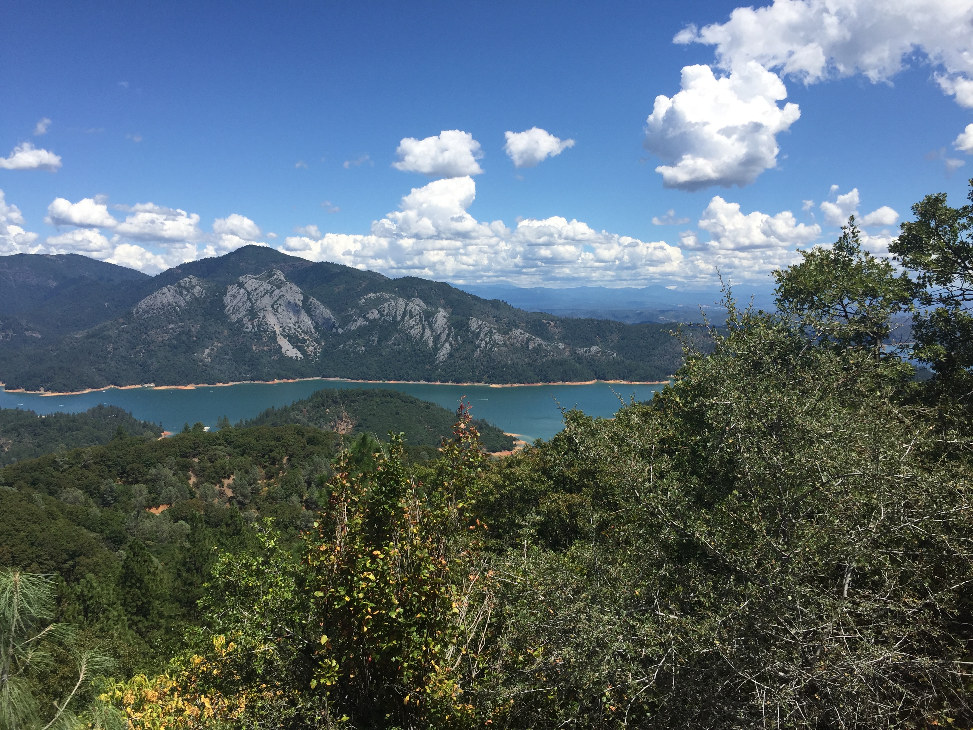
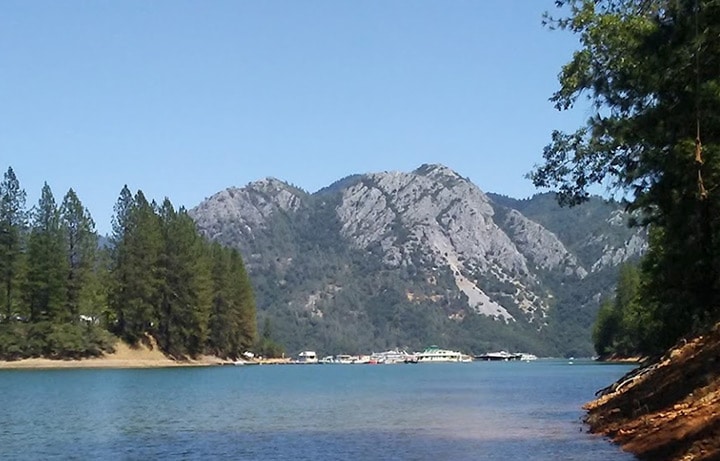
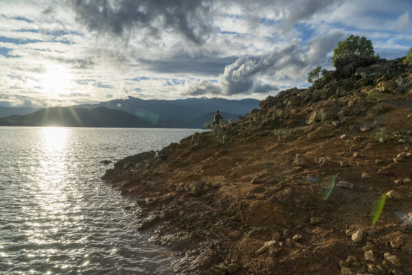
The Trail is steep and is considered to be moderately challenging. It starts from the Greens Creek Boat-in Campground and it’s a 1,230 feet climb to the Ridge on this 6 mile course. This Trail does provide some amazing views. The Trail passes through magnificent Limestone Formations that separate the McCloud and Squaw Creek Arms and then descends back to the Lake Level near the historic Mining Town of Bully Hill, where you can still see remains of the Bully Hill Zinc and Copper Mine that was in operation from 1870 to 1919. BOAT ACCESS ONLY: Go to the East side of the McCloud River or to Bear Cove on the Southwest Squaw Creek Arm.
Bailey Cove Trail
The Trail is 3.1 miles
This is a Loop Trail that takes about an hour to complete and is considered moderately challenging. The Trail is single track dirt and parallels the Shoreline. Some of the access is steep. Bailey Cove Trail is popular for Sightseeing, Fishing, Swimming and its Public Boat Ramp. There is a day use area and there is also a beautiful forested Campground. BY CAR: Take I-5 to Exit 695, Turn Right and then follow Shasta Caverns Road to Bailey Cove. BY BOAT: Go to the West side of the McCloud Arm
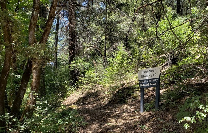
Sugarloaf Creek Trail
The trail is 2 miles
BY BOAT: The trail is accessible at Sugarloaf Creek, crossing on the Sacramento River Arm.
Clikapudi Trail
The Trail is a 7.6 – mile loop.
“Photo Courtesy of John Soares from Northern California Hiking Trails” https://northerncaliforniahikingtrails.com/blog/
Clikapudi Trail is the longest maintained Trail on Lake Shasta where you can see great views of the Mountains, explore the Pit River Arm and Clikapudi Creek. This Trail is considered Moderately Difficult. This is a popular trail for Hiking, Horseback Riding and Mountain Biking. It is accessible from three Trailheads, one at the Jones Valley Campground, also Jones Valley Boat Ramp Parking Lot and halfway between, where the Trail crosses Forest Road 33N03.
BY BOAT: The trail starts at Jones Valley Campground on the Pit River Arm and ends at the boat ramp.
Hirz Bay Trail
The Trail is 1.6 miles
The trail begins and ends at day use areas near Campgrounds: Hirz Bay and Dekkas Rock. It’s a scenic walk following the Shoreline and crossing shady Creeks over wooden Bridges with great vistas of the Lake. The Trail passes by Limestone Rock Formations and winds through groves of many types of Trees. There are day use areas that have Parking, Bathrooms, and other Amenities.
BY BOAT: The trail can be hiked from Hirz Bay Amphitheater or Dekkas Rock Campground on the northwest McCloud Arm.
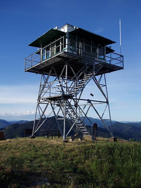
Hirz Mountain Lookout
This 20-foot Lookout Tower comes with a full 360-degree view. The Lookout is available for rent to the Public seasonally–by Reservation only–to anyone 18 years of age or older. Seasons normally run from May 1st through October 15th. The Lookout has a maximum capacity of four People. The Rental Fee is $75 per night with a maximum four-day stay per group/per year. Check-in time is 2:00 p.m. Check-out time is 11:00 a.m. Make reservations to stay by calling the National Recreation Reservation Service (NRRS) at 1-877-444-6777 or by contacting them through the web at www.Recreation.gov.
BY CAR: Take I5 to Gilman Road, Exit 698, follow Gilman Road 5 miles to Road 35N04, Turn Left on to a limited sight distance single lane dirt Road. Road 35N04 is a high clearance Mountainous Road recommended for 4-wheel Drive Vehicles. Due tp slippery, steep terrain the last 1/4 mile of road access is for foot traffic only.
Dry Fork Trail
The Trail is 4.7 miles
This Trail was made to extend fishing access North of Shasta Dam. There are great views of the lake and Mt. Shasta and lots of opportunities to fish and swim.A trail following the shoreline to the Dry Creek Inlet. Great fishing and panoramic views.
BY BOAT: The Trail is on the West side of Shasta Dam at a County Road that is only accessible when the Lake is down 15 feet or more.
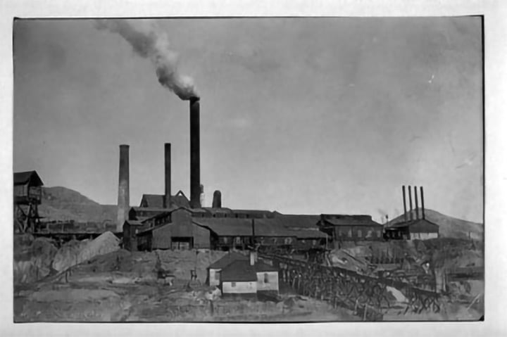
Photo Collection: Relating to the Lawerence May Family. Contributor: The Bancroft Library, University of CA., Berkeley.
Bully Hill Mine
A scenic two-mile walk crossing creeks and great vistas.
Waterfalls
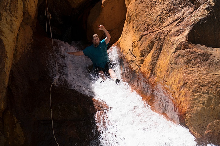
Little BackBone RockSlide
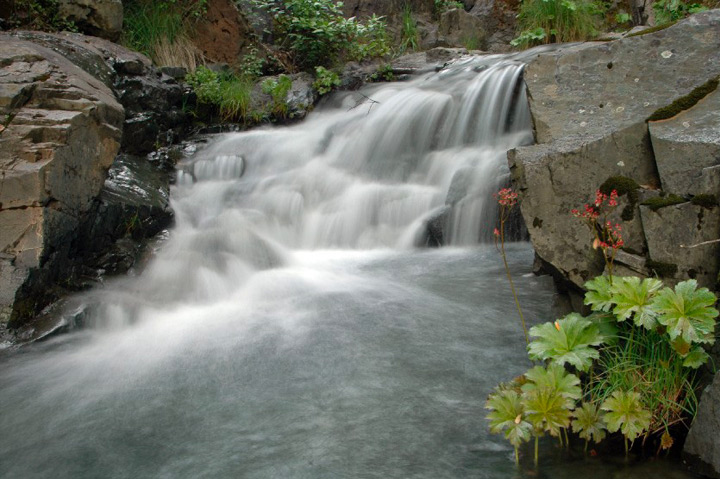
Waters Gulch
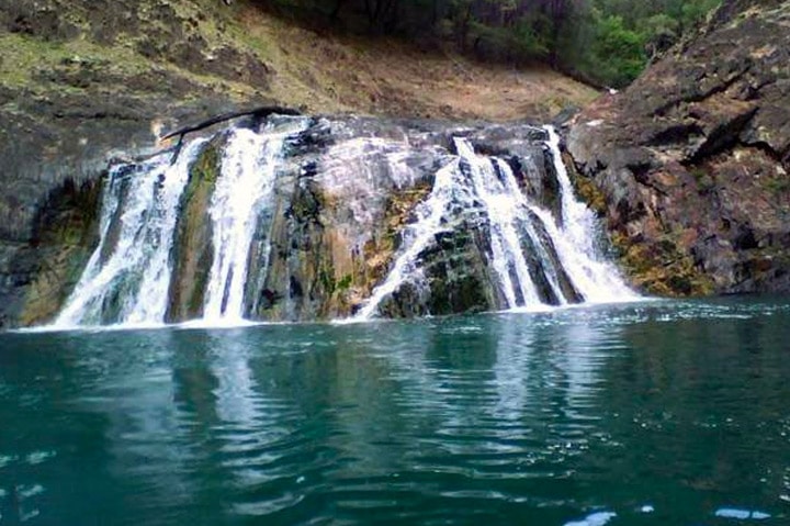
Bear Creek Falls
Indian Creek Falls
BY BOAT: Access the waterfall across from the Antlers Resort on the Sacramento Arm.

Potem Falls
BY BOAT: Beach the boat close to the Pit 7 Dam in a safe place. Beware of dangerous conditions for parking your boat. Hike up to Fenders Ferry Road. Go over the bridge and follow the road one (1) mile.